Photographic Commissions
... from Owen Sound & North Grey Union Library
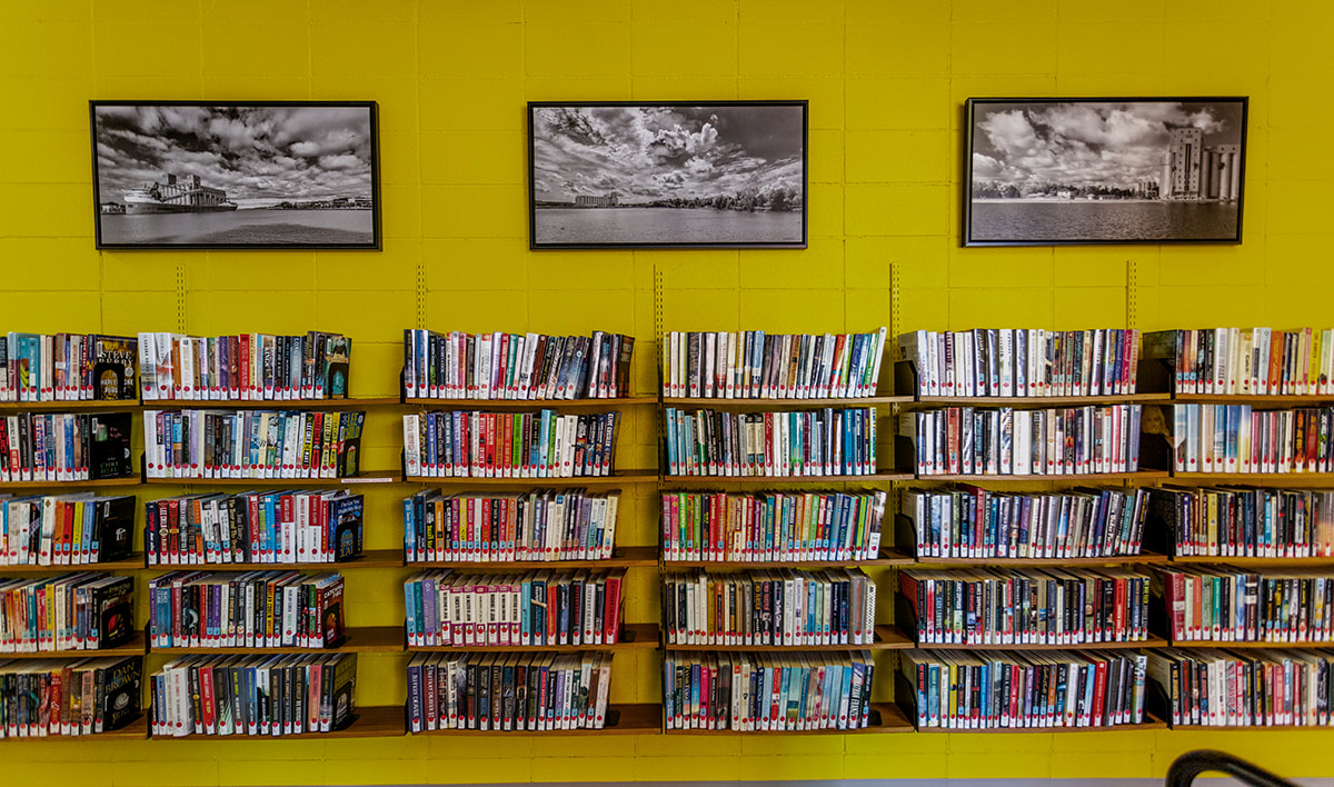
The Owen Sound and North Grey Union Library asked for three 40" X 20" photographs of Owen Sound Harbour, mounted on masonite and framed, to be displayed as part of major renovation work in 2018. An artist statement and information on each photo was also requested.
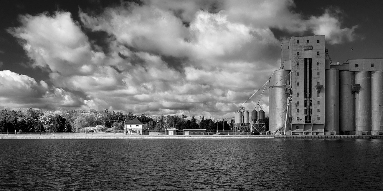
The Great Lakes Elevator Co. - Owen Sound Inner Harbour, 2015
I photographed this image in the late morning on a crisp day in October with no haze and a sky full of scudding clouds. What I came to photograph though was the contrast in size between the two buildings; the office and the elevator.
Generations of Owen Sounders have lived, worked and played under the shadow of this immense structure and it is an important touchstone for them. For close to a hundred years it has stood there as mute witness to their life and work in Owen Sound.
Situated on a spit of land between the Pottawatomi River and the Sydenham River this was the second grain elevator to be built in the inner harbour. It was constructed in 1925 by the City of Owen Sound, fourteen years after fire razed the Canadian Pacific grain elevator on the harbour’s east-side. After many years without the grain trade the venture was a great success and brought new growth to the city.
When the inner harbour was created in the mouth of the Sydenham River lake vessels were small and there were few steam ships. As commerce on the lakes increased so did the size of the boats. To survive as a competitive Great Lakes port Owen Sound needed to provide access for larger vessels and the river mouth was dredged in1860.
An accessible inner harbour also attracted the railways and by 1885 Canadian Pacific Railway had established it western Terminus on the east side of the harbour. The Grand Trunk Railway arrived on the west side in 1894. The last trains left Owen Sound in the late 1980s.
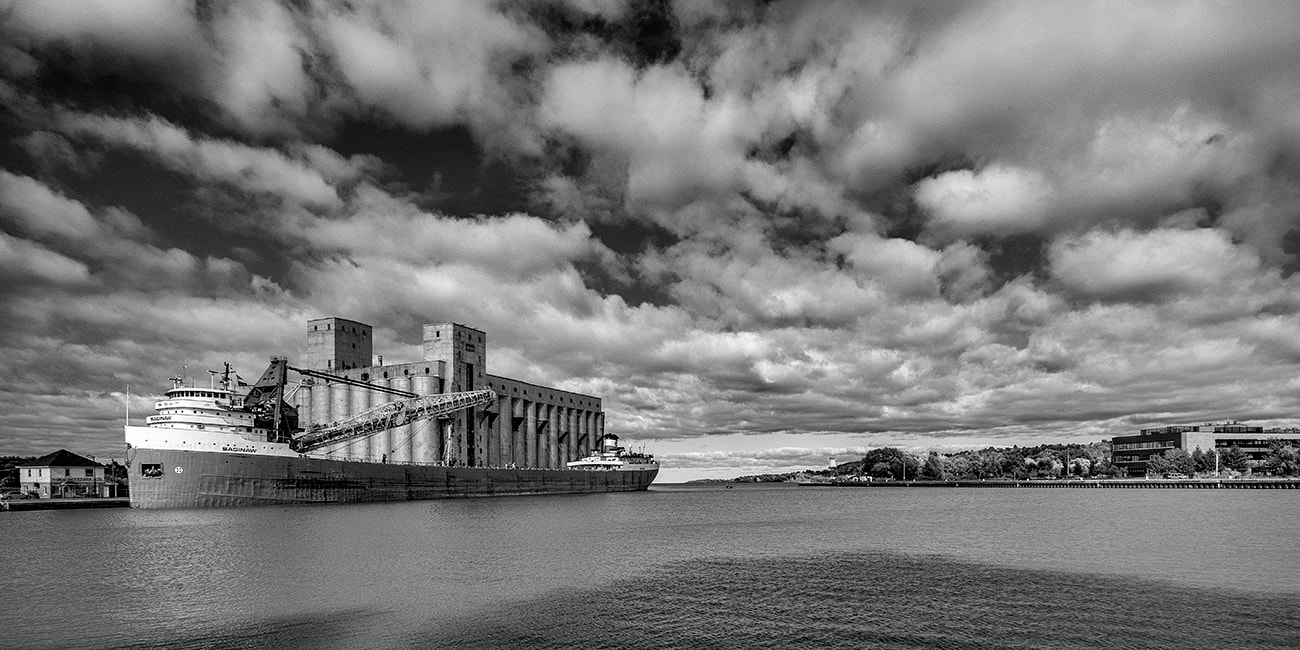
M.V. Saginaw at the Elevator - Owen Sound Inner Harbour, 2018
This photograph of the 66-year-old bulk carrier M.V. Saginaw was taken on the west bank of the harbour looking north. With the sun in the southwest her white and grey bow as well the south side of the elevator are nicely highlighted. From this vantage point I could also include at least a portion of the east side of the harbour.
The Saginaw was a new boat in the 1950s and 60s, known then as the John J. Boland. At that time Owen Sound harbour was home port to the Hindman Transportation Company, a Great Lakes shipping company that employed 300 to 400 people from ships’ crews to machine shop workers. When Hindman Transportation closed in 1977 the harbour became a quieter place.
History lies just under surface on both sides of this once busy industrial harbour. Take a walk along the harbour’s west side to see remnants of the old wharves lying just beneath the water. And on the east side you will see the Grey Bruce Health Unit, a large, modern structure, that stands on the long ago filled in turn-around slip for the Canadian Pacific fleet.
A few lake boats like the Saginaw still visit regularly delivering their cargoes to the elevator or unloading at the cement silo, but it is no longer the busy port it was in the last century.
The Chi-Cheemaun, ferry between Tobermory and Manitoulin Island, calls Owen Sound harbour home and lays up here for the winter. Occasionally other ships will winter in the harbour depending on schedules and lake conditions.
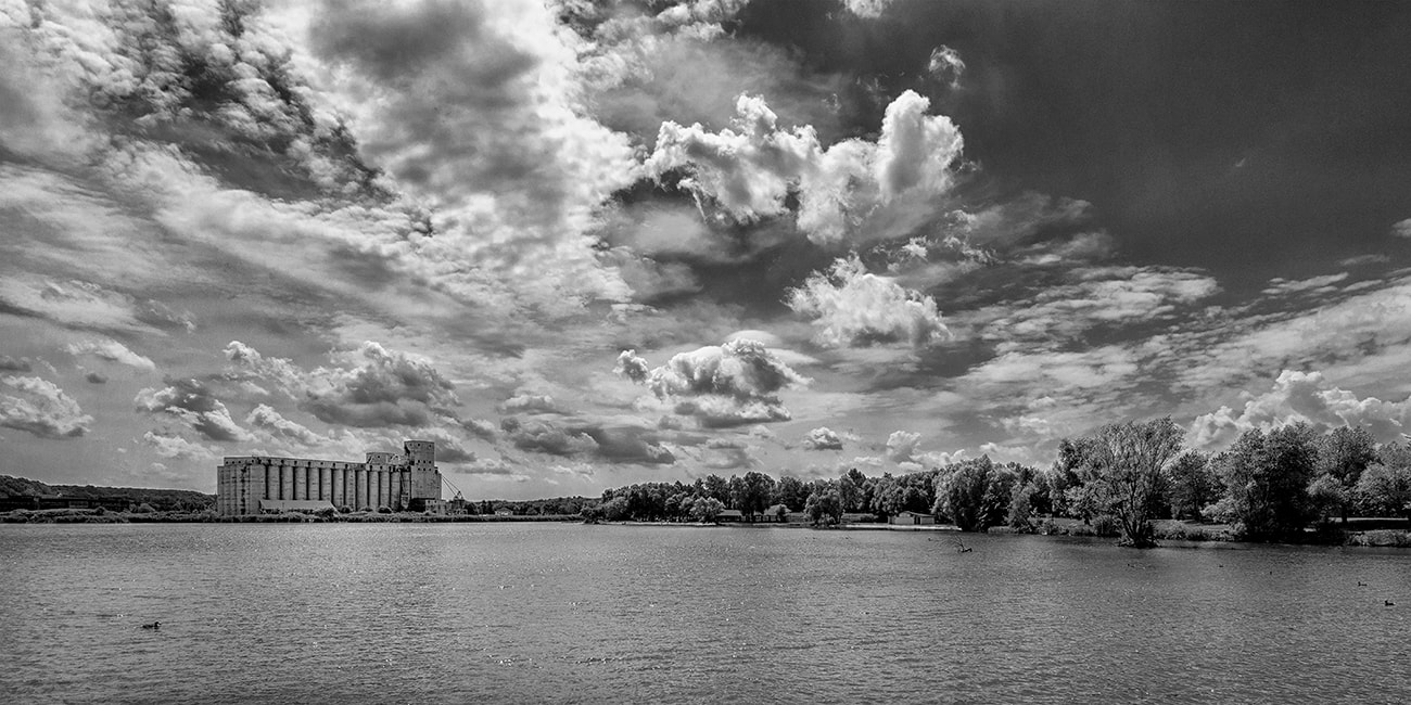
Newash - North of the Pottawatomi River- Owen Sound Outer Harbour, 2018
Owen Sound and its harbour are on the traditional territory of the Anishinaabe Peoples and I wish to recognize the long history of First Nations and Métis Peoples in Ontario and show respect to them with this photograph of part of their traditional territory.
Taken in late summer this is an image of the First Nations ancient Nawash settlement on the west-side of Owen Sound Bay. It was a central location the people returned to after wintering in the hunting territories. The shoreline seen here, extends from the mouth of the Pottawatomi River north to the breakwater around the marina.
By 1857 the continued growth of the Owen Sound caused the Crown to take over the lands of the Nawash settlement and relocate the residents to Cape Croker, now officially named Neyaashiinigmiing.
As the European settlement of Sydenham, as Owen Sound was first named, grew at the base of Owen Sound Bay an outer harbour developed that would prove to be as important as the inner harbour. Shipping supplies to the new settlement proved to be difficult. The overland route was indirect and commercial sailing traffic inconsistent because getting larger boats into the inner harbour was difficult due to the marshy river mouth.
So, in 1844, W.C. Boyd, an early entrepreneur, built a wharf on the east shore of the outer harbour for larger vessels including his own 15-ton schooner, the Fly. The wharf was built in the vicinity of today’s Bayshore Community Centre. Industries eventually located along the shores of the outer harbour, many building their own wharves.
Artist Statement for the Project
When photographing Owen Sound harbour, I find myself reflecting on its physical duality. It has two harbours: the inner and the outer, two river mouths: the Sydenham and the Pottawatomi and two elevators: the large multiple silo structure on the west side and the double silo on the east side. At one time two railway lines serviced the harbour: the Canadian Pacific and the Canadian National and those two historical railway stations still exist, one on each side of the inner harbour.
I find harbours to be great places to research and reflect on the history of the relationship between human endeavours and nature. I love to photograph them. Research and reflection help me pre-visualize my photographs by determining specific subject matter, the camera’s point of view and the composition of the shot. Factors such as the quality and direction of light determine the time of day and even the time of year. I use a Canon 5D Mark II, DSLR camera and usually carry two lenses: A Canon L Series 17- 40 f4 and a Canon L Series 70-200, f2.8. Once on location changing conditions might warrant further technical considerations before the pre-visualized idea is realized and the shutter released.
So, you might see me wandering around a harbour at different hours, on different days and in different seasons just soaking up the ambience as I work out details for the final shot. I grew up and live in Owen Sound and a walk around the city’s harbour is, if not a daily habit, it is at least a weekly one. And over the years I’ve noticed that today’s harbour has developed another aspect to its duality. It may no longer be a busy harbour lined with industries, but the lake boats still come into port. They may come to unload their cargos or wait out the winter, but they now share the harbour with people: People walking or biking the harbour trails and people using the harbour for recreational boating of all kinds including, rowing, dragon-boat paddling and sports fishing.
... from Mr. Richard Van Dyk
Car Culture
...from Mr. Walther
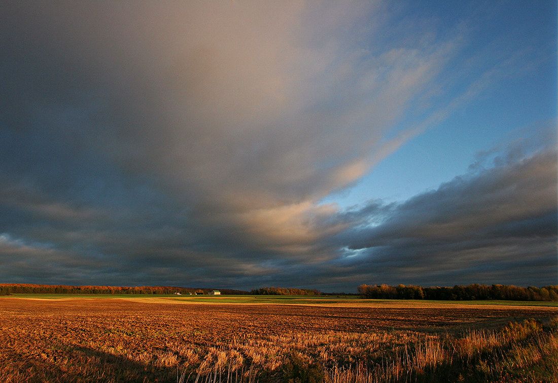
Mr. Walther, from Texas and a seasonal resident on the Saugeen Peninsula (Bruce Peninsula), ON commissioned a photo of the view from the corner of Bruce County Rd 9 and Concession Rd 4, east of Ferndale.